


Blueprint Developer Manual / Version 2210
Table Of ContentsOpen Street Map is a project that creates and provides free geographic data and mapping. CoreMedia Blueprint supports an Open Street Map integration scenario:
The OpenStreetMap property field (
OSMPropertyField.ts) offers a convenient method to visually edit geographic coordinates. It displays a map segment, and users can just drag a marker to the location they want to point out. Internally, a pair of geographic coordinates (longitude/latitude) is stored in a string property field
OpenStreetMap Support is bundled in a Blueprint extension. Note that in order for the integration to work properly, the machine hosting the CoreMedia Studio web application needs to have Internet access. On startup, a connectivity check is performed, and when the machine cannot reach the OSM servers, the extension is automatically turned off.
If you have changed the default group id of the Blueprint, the property
osm.groupId of OSMStudioPlugin.properties has to be adapted accordingly.
Alternatively, an absolute URL for another marker icon can be specified. In that case, the
osm.groupId should remain empty or should be removed completely.
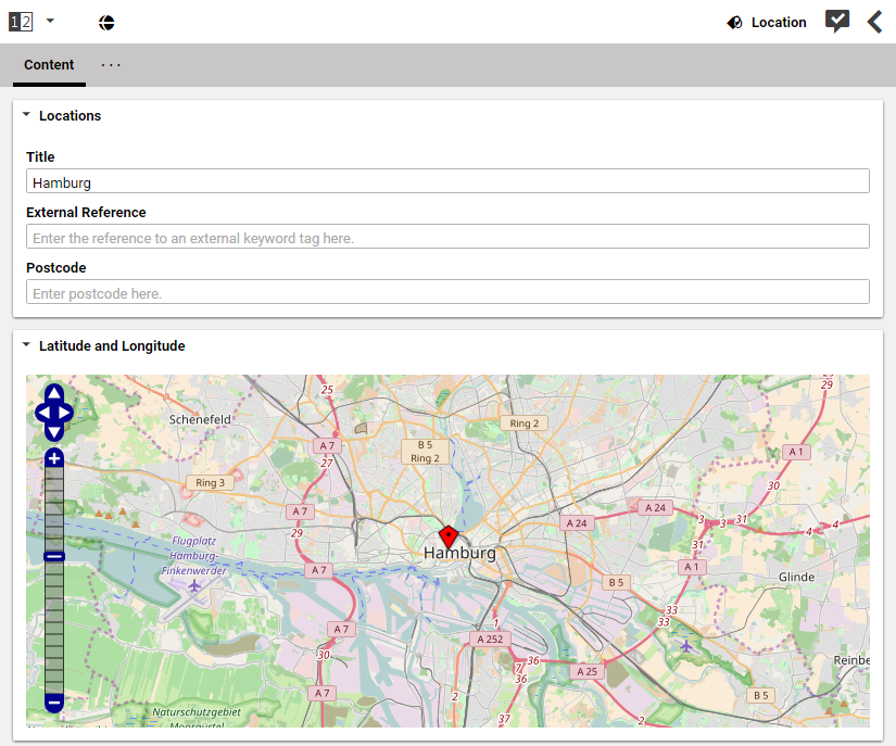
The OpenStreetMap property editor gives the editor the possibility to update the geographic location just by dragging a marker.
